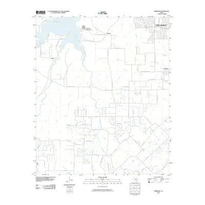
2010 Map of Primrose
USGS Topo · Published 2010About this map
Saint Francis Village sits on the eastern shore of Benbrook Lake, defining the northwestern corner of this transition from urban Fort Worth to more rural Tarrant County terrain. The landscape is characterized by the hydrological network of Mustang Creek, Rock Creek, and Deer Creek, which drain the open spaces south of the city. While residential developments are beginning to push westward from Crowley, much of the area remains structured by a grid of county roads and family-named routes like Stewart Feltz Rd and Ben Day Murrin Rd. Significant infrastructure includes the Saint Francis Village Water Treatment Facility and Clark Dam, supporting the local community. A point of historical transit interest is the Old Cleburne Crowley Junction, which hints at the former rail connectivity that once linked these southern prairie settlements to the regional commercial hubs.
Find a feature on this map
54 named features on this map. Tap any name to fly to it.
Don’t see what you’re looking for? This feature index may not catch every label — zoom into the map to look around manually.
Map Details
Editions of this 2010 Primrose Map
This is the sole edition of this map. No revisions or reprints were ever made.
Other maps of this area

1889 · Granbury
USGS Topo · 1:125,000

1891 · Weatherford
USGS Topo · 1:125,000

1891 · Cleburne
USGS Topo · 1:125,000

1893 · Weatherford
USGS Topo · 1:125,000

1894 · Cleburne
USGS Topo · 1:125,000

1894 · Fort Worth
USGS Topo · 1:125,000

1928 · Godley
USGS Topo · 1:62,500

1954 · Dallas
USGS Topo · 1:250,000

1955 · Burleson
USGS Topo · 1:24,000

1955 · Aledo
USGS Topo · 1:24,000