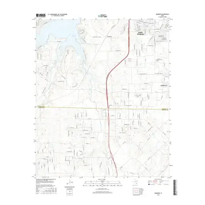
2016 Map of Primrose
USGS Topo · Published 2016About this map
Benbrook Lake and its western peninsulas dominate the northwestern corner of this Texas landscape, where the waters of Rocky Creek flow into the reservoir. This mid-2010s survey shows the suburban expansion of Fort Worth and Crowley pushing into formerly rural ranch land. The Chisolm Trail Pkwy serves as a major north-south arterial through the center of the map, bridging the transition from developed residential blocks to the open drainage basins of Rock Creek and Mustang Creek. Local points of interest include the planned community of Saint Francis Village and several family-named landmarks like Ricky Ranch. The map also captures the precise boundary line between Tarrant County and Johnson County, illustrating how modern infrastructure and legacy farm-to-market roads like FM 1187 navigate the creeks and undulating terrain of the prairie south of the city.
Find a feature on this map
160 named features on this map. Tap any name to fly to it.
Don’t see what you’re looking for? This feature index may not catch every label — zoom into the map to look around manually.
Map Details
Editions of this 2016 Primrose Map
This is the sole edition of this map. No revisions or reprints were ever made.
Other maps of this area

1889 · Granbury
USGS Topo · 1:125,000

1891 · Weatherford
USGS Topo · 1:125,000

1891 · Cleburne
USGS Topo · 1:125,000

1893 · Weatherford
USGS Topo · 1:125,000

1894 · Cleburne
USGS Topo · 1:125,000

1894 · Fort Worth
USGS Topo · 1:125,000

1928 · Godley
USGS Topo · 1:62,500

1954 · Dallas
USGS Topo · 1:250,000

1955 · Burleson
USGS Topo · 1:24,000

1955 · Aledo
USGS Topo · 1:24,000