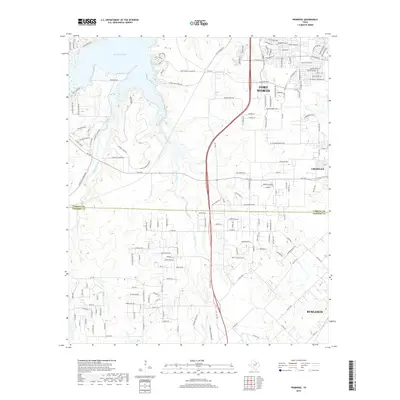
2019 Map of Primrose
USGS Topo · Published 2019About this map
Primrose and the southern reaches of Fort Worth sit at the center of this 2019 survey, where the expanding suburban landscape meets the rolling drainage of the Rock Creek basin. The map illustrates a transitional geography defined by large-scale residential development north of the Tarrant County line and more dispersed rural holdings to the south in Johnson County. The northeastern waters of Benbrook Lake and the western course of Mustang Creek anchor the hydrology of the area, while the rugged elevation of Mariposa Ridge stands as a prominent natural landmark amidst the growing road network. This era shows the modern connectivity of the region, anchored by historical routes like Old Granbury Rd and Saint Francis Village Rd, providing a clear record of the interface between the urbanized outskirts of Crowley and the rural plains leading toward Burleson.
Find a feature on this map
29 named features on this map. Tap any name to fly to it.
Don’t see what you’re looking for? This feature index may not catch every label — zoom into the map to look around manually.
Map Details
Editions of this 2019 Primrose Map
This is the sole edition of this map. No revisions or reprints were ever made.
Other maps of this area

1889 · Granbury
USGS Topo · 1:125,000

1891 · Weatherford
USGS Topo · 1:125,000

1891 · Cleburne
USGS Topo · 1:125,000

1893 · Weatherford
USGS Topo · 1:125,000

1894 · Cleburne
USGS Topo · 1:125,000

1894 · Fort Worth
USGS Topo · 1:125,000

1928 · Godley
USGS Topo · 1:62,500

1954 · Dallas
USGS Topo · 1:250,000

1955 · Burleson
USGS Topo · 1:24,000

1955 · Aledo
USGS Topo · 1:24,000