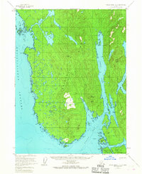
1955 Map of Prince Rupert D-3
USGS Topo · Published 1967About this map
Tongass National Forest covers this maritime landscape at the southernmost edge of the Alaska Panhandle, where the mainland meets the complex waterways of the Alexander Archipelago. Deep inlets like Nakat Inlet and Harry Bay carve into the peninsula, while the Revillagigedo Channel forms a broad maritime highway to the west. The area is defined by its coastal geography, featuring prominent landmarks such as Cape Fox and the De Long Islands. Small cabins are noted near the shoreline, hinting at the seasonal fishing and trapping activities that sustained local inhabitants during the mid-20th century.
Find a feature on this map
49 named features on this map. Tap any name to fly to it.
Don’t see what you’re looking for? This feature index may not catch every label — zoom into the map to look around manually.
Map Details
Editions of this 1955 Prince Rupert D-3 Map
2 editions found
Other maps of this area

1951 · Prince Rupert
USGS Topo · 1:250,000

1952 · Ketchikan
USGS Topo · 1:250,000

1955 · Ketchikan A-2
USGS Topo · 1:63,360

1955 · Prince Rupert D-3
USGS Topo · 1:63,360

1955 · Ketchikan A-4
USGS Topo · 1:63,360
1955 · Prince Rupert D-4
USGS Topo · 1:63,360

1955 · Ketchikan A-3
USGS Topo · 1:63,360

1955 · Prince Rupert D-2
USGS Topo · 1:63,360

1955 · Ketchikan
USGS Topo · 1:250,000
1958 · Prince Rupert C-2 and C-3
USGS Topo · 1:63,360