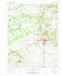
1959 Map of Princeton
USGS Topo · Published 1965About this map
Princeton serves as the focal point of this Gibson County survey, revealing a mid-century landscape defined by the convergence of the White River, Wabash River, and Patoka River. The intricate drainage network of the Wabash lowlands is visible through numerous named ditches and runs, such as Stormont Ditch and David Run, which supported the region's agricultural development. The industrial and transit infrastructure of the era is well-represented, from the Oil Refinery near King to the bustling rail lines of the New York Central and Chicago and Eastern Illinois railroads. Social and civic life is anchored by rural landmarks like Decker Chapel, Riley Sch, and the County Farm. Notable terrain features like Hanging Rock and Bald Hill break the river-bottom flats, while Camp Carson stands as a distinct military footprint east of the county seat.
Find a feature on this map
76 named features on this map. Tap any name to fly to it.
Don’t see what you’re looking for? This feature index may not catch every label — zoom into the map to look around manually.
Map Details
Editions of this 1959 Princeton Map
2 editions found
Other maps of this area

1901 · Princeton
USGS Topo · 1:62,500

1901 · Haubstadt
USGS Topo · 1:62,500

1902 · Ditney
USGS Topo · 1:125,000

1902 · Boonville
USGS Topo · 1:62,500

1903 · Haubstadt
USGS Topo · 1:62,500

1903 · New Harmony
USGS Topo · 1:62,500

1903 · Petersburg
USGS Topo · 1:62,500

1903 · Princeton
USGS Topo · 1:62,500

1903 · Patoka
USGS Topo · 1:125,000

1904 · Mount Carmel
USGS Topo · 1:62,500