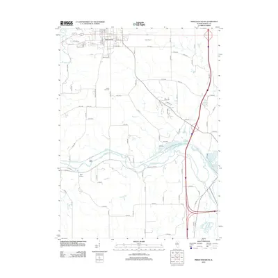
2012 Map of Princeton South
USGS Topo · Published 2012About this map
Princeton serves as the northern anchor of this Illinois landscape, where the southern reaches of the city transition into a network of fertile bottomlands and winding waterways. The topography is defined by the significant path of Big Bureau Cr and its tributary E Bureau Cr, which meander through the central and eastern portions of the quadrangle. These watercourses are flanked by distinctive terrain features such as Owls Head and the valley of Plow Hollow.
Find a feature on this map
82 named features on this map. Tap any name to fly to it.
Don’t see what you’re looking for? This feature index may not catch every label — zoom into the map to look around manually.
Map Details
Editions of this 2012 Princeton South Map
This is the sole edition of this map. No revisions or reprints were ever made.
Other maps of this area

1893 · Lacon
USGS Topo · 1:62,500

1893 · Hennepin
USGS Topo · 1:62,500

1909 · Hennepin
USGS Topo · 1:62,500

1911 · Hennepin
USGS Topo · 1:62,500

1921 · Buda
USGS Topo · 1:62,500

1923 · Buda
USGS Topo · 1:62,500

1933 · Lacon
USGS Topo · 1:62,500

1933 · Camp Grove
USGS Topo · 1:48,000

1937 · Lacon
USGS Topo · 1:62,500

1945 · Bradford
USGS Topo · 1:62,500