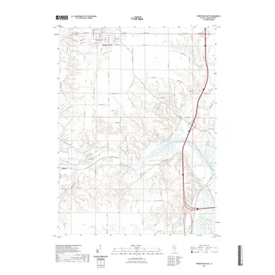
2021 Map of Princeton South
USGS Topo · Published 2021About this map
Princeton serves as the focal point of this Bureau County landscape, where the southern edge of the city gives way to the winding valley of Big Bureau Creek. The township's civic heart is clearly marked by the Bureau County Courthouse, while the residential grid transitions south into a network of rural routes like Lovers Lane Rd and Deerfield Rd. To the southwest, the village of Tiskilwa sits at the base of the bluff near Plow Hollow, illustrating the region’s traditional settlement patterns along the valley floor. The map documents the intricate hydrography of the area, showing the Old Channel Big Bureau Cr alongside more recent water features like Lake Rawson. This modern survey provides a clear view of how long-standing local landmarks, such as Oakland Cem, coexist with contemporary transportation corridors and the prominent elevation at Owls Head.
Find a feature on this map
85 named features on this map. Tap any name to fly to it.
Don’t see what you’re looking for? This feature index may not catch every label — zoom into the map to look around manually.
Map Details
Editions of this 2021 Princeton South Map
This is the sole edition of this map. No revisions or reprints were ever made.
Other maps of this area

1893 · Lacon
USGS Topo · 1:62,500

1893 · Hennepin
USGS Topo · 1:62,500

1909 · Hennepin
USGS Topo · 1:62,500

1911 · Hennepin
USGS Topo · 1:62,500

1921 · Buda
USGS Topo · 1:62,500

1923 · Buda
USGS Topo · 1:62,500

1933 · Lacon
USGS Topo · 1:62,500

1933 · Camp Grove
USGS Topo · 1:48,000

1937 · Lacon
USGS Topo · 1:62,500

1945 · Bradford
USGS Topo · 1:62,500