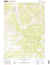
1956 Map of Pringle
USGS Topo · Published 1979About this map
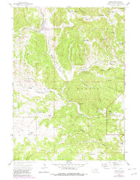
Pringle serves as the primary hub in this mid-century look at the southern Black Hills, where the Chicago Burlington and Quincy railroad tracks run parallel to Beaver Valley. The landscape is a network of cattle ranching and mineral extraction, evidenced by numerous family operations such as Bowman Ranch, Corey Ranch, and Ziemet Ranch. Mining activity is concentrated north of the main settlement, featuring the Myrtle Ann Mine, Townsite Mine, and a Lime Kiln.
Find a feature on this map
53 named features on this map. Tap any name to fly to it.
Don’t see what you’re looking for? This feature index may not catch every label — zoom into the map to look around manually.
Map Details
Editions of this 1956 Pringle Map
5 editions found
Other maps of this area

1894 · Hermosa
USGS Topo · 1:125,000

1896 · Oelrichs
USGS Topo · 1:125,000

1896 · Harney Peak
USGS Topo · 1:125,000

1900 · Oelrichs
USGS Topo · 1:125,000

1901 · Hermosa
USGS Topo · 1:125,000

1901 · Harney Peak
USGS Topo · 1:125,000

1902 · Edgemont
USGS Topo · 1:125,000

1950 · Hot Springs
USGS Topo · 1:24,000

1950 · Minnekahta
USGS Topo · 1:24,000

1951 · Minnekahta NE
USGS Topo · 1:24,000