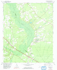
1979 Map of Pringletown
USGS Topo · Published 1992About this map
Four Hole Swamp dominates this landscape along the border of Berkeley and Dorchester counties, creating a dense network of braided wetlands and creek branches. In the late 1970s, this area remained largely rural, centered around the settlement of Pringletown and a significant cluster of community churches such as Mt Pisgah Ch, Bethel Ch, and the House of God. The map reveals a transition from the heavy vegetation of the swamp to the developed grounds of the Mac Dougall Youth Correction Center, which includes its own Landing Strip and Sewage Disposal Pond. Local water bodies like Lake Merkel and numerous named branches, including Rock Branch and Timothy Creek, define the drainage patterns. For the genealogist, the distribution of churches and small cemeteries provides a clear view of the social geography and family settlements in this corner of the South Carolina Lowcountry.
Find a feature on this map
32 named features on this map. Tap any name to fly to it.
Don’t see what you’re looking for? This feature index may not catch every label — zoom into the map to look around manually.
Map Details
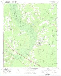
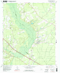
Editions of this 1979 Pringletown Map
3 editions found
Other maps of this area

1919 · Summerville
USGS Topo · 1:48,000

1919 · Ridgeville
USGS Topo · 1:48,000

1920 · Eutawville
USGS Topo · 1:48,000

1920 · Chicora
USGS Topo · 1:48,000

1920 · Ridgeville
USGS Topo · 1:62,500

1920 · Summerville
USGS Topo · 1:62,500

1921 · Chicora
USGS Topo · 1:62,500

1921 · Eutawville
USGS Topo · 1:62,500

1943 · Chicora
USGS Topo · 1:62,500

1943 · Ridgeville
USGS Topo · 1:62,500