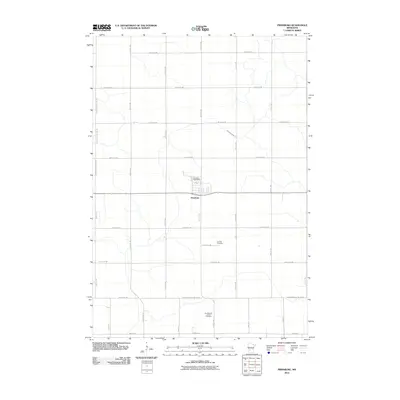
2010 Map of Prinsburg
USGS Topo · Published 2010About this map
Prinsburg serves as the central hub for this rural landscape in Kandiyohi County, where the grid of agricultural roads defines the township's character. The village is anchored by the Prinsburg Post Office, situated along the intersection of 6th St and a primary east-west corridor. The map reveals the deep cultural roots of the area through its burial sites, including the Old Swedish Lutheran Cemetery to the south and the Holland Cemetery located further north. These landmarks, along with the meandering path of Chetomba Creek, provide a detailed view of the settlement patterns that emerged between the Kandiyohi, Chippewa, and Renville county lines. The surveyed road network, from 890th Ave to 135th Ave SW, reflects a century of land division and local movement across the Minnesota prairie.
Find a feature on this map
30 named features on this map. Tap any name to fly to it.
Don’t see what you’re looking for? This feature index may not catch every label — zoom into the map to look around manually.
Map Details
Editions of this 2010 Prinsburg Map
This is the sole edition of this map. No revisions or reprints were ever made.
Other maps of this area

1953 · New Ulm
USGS Topo · 1:250,000

1953 · Saint Cloud
USGS Topo · 1:250,000

1957 · Saint Cloud
USGS Topo · 1:250,000

1957 · New Ulm
USGS Topo · 1:250,000

1958 · New Ulm
USGS Topo · 1:250,000

1958 · Saint Cloud
USGS Topo · 1:250,000

1958 · Kerkhoven SE
USGS Topo · 1:24,000

1958 · Raymond
USGS Topo · 1:24,000

1958 · Willmar
USGS Topo · 1:24,000

1965 · Danube
USGS Topo · 1:24,000