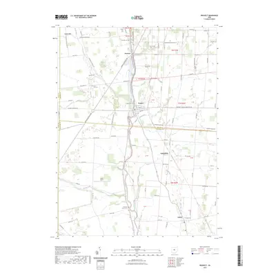
2023 Map of Prospect
USGS Topo · Published 2023About this map
The Scioto River winds through this central Ohio landscape, serving as a focal point for the settlements of Prospect and Radnor. This 2023 survey delineates the rural character of the region where Marion, Delaware, and Union Counties meet. Smaller hamlets like Centerville, Newmans, and Robertsburg are connected by a network of established roads such as Centerville Prospect Rd and Marion Marysville Rd. The area is notably dense with small family and township burial grounds, including Brown Taylor Cem, Walls Cem, and the Markel - Kirts Cem, providing significant touchstones for local genealogical research. In the southwest, Packer Airport sits near the banks of Ottawa Creek, while various runs like Battle Run and Kehler Run drain the surrounding agricultural fields into the main river valley.
Find a feature on this map
86 named features on this map. Tap any name to fly to it.
Don’t see what you’re looking for? This feature index may not catch every label — zoom into the map to look around manually.
Map Details
Editions of this 2023 Prospect Map
This is the sole edition of this map. No revisions or reprints were ever made.
Other maps of this area

1903 · Marion
USGS Topo · 1:62,500

1905 · Marion
USGS Topo · 1:62,500

1913 · Richwood
USGS Topo · 1:62,500

1915 · Richwood
USGS Topo · 1:62,500

1915 · La Rue
USGS Topo · 1:62,500

1924 · Delaware
USGS Topo · 1:62,500

1925 · Delaware
USGS Topo · 1:62,500

1944 · Richwood
USGS Topo · 1:62,500

1944 · Delaware
USGS Topo · 1:62,500

1950 · Marion
USGS Topo · 1:250,000