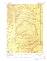
1956 Map of Prospect
USGS Topo · Published 1977About this map
The Rogue River carves through a landscape of dense national forests and volcanic peaks in this mid-century survey of southern Oregon. The settlement at Prospect and the community at Union Creek serve as the primary hubs along Highway 62, which provides access to the northwestern boundary of Crater Lake National Park. The map documents a network of US Forest Service infrastructure within the Rogue River National Forest and Umpqua National Forest, including the Huckleberry Guard Station and an Abandoned Lookout atop Anderson Mtn.
Find a feature on this map
67 named features on this map. Tap any name to fly to it.
Don’t see what you’re looking for? This feature index may not catch every label — zoom into the map to look around manually.
Map Details
Editions of this 1956 Prospect Map
3 editions found

Other maps of this area

1891 · Ashland
USGS Topo · 1:250,000

1893 · Ashland
USGS Topo · 1:250,000

1897 · Ashland
USGS Topo · 1:250,000

1917 · Diamond Lake
USGS Topo · 1:125,000

1944 · Abbott Butte
USGS Topo · 1:62,500

1947 · Abbott Butte
USGS Topo · 1:62,500

1954 · Butte Falls
USGS Topo · 1:62,500

1955 · Quartz Mtn
USGS Topo · 1:62,500

1955 · Rustler Peak
USGS Topo · 1:62,500

1955 · Pelican Butte
USGS Topo · 1:62,500