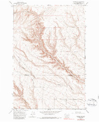
1965 Map of Prosser
USGS Topo · Published 1987About this map
The boundary between Yakima and Klickitat Counties cuts through this high desert plateau, where the landscape is defined by deep, winding drainage systems. Glade Creek meanders through a significant canyon that bisects the terrain, joined by the branching paths of Coyote Canyon and Dead Canyon. These natural features dictated the placement of early infrastructure, as seen with Dead Canyon Road following the contours of the land.
Find a feature on this map
13 named features on this map. Tap any name to fly to it.
Don’t see what you’re looking for? This feature index may not catch every label — zoom into the map to look around manually.
Map Details
Editions of this 1965 Prosser Map
3 editions found
Other maps of this area

1915 · Prosser
USGS Topo · 1:125,000

1917 · Prosser
USGS Topo · 1:125,000

1950 · Grandview
USGS Topo · 1:62,500

1951 · Grandview
USGS Topo · 1:62,500

1951 · Corral Canyon
USGS Topo · 1:62,500

1953 · Walla Walla
USGS Topo · 1:250,000

1955 · Prosser SW
USGS Topo · 1:24,000

1958 · Walla Walla
USGS Topo · 1:250,000

1965 · Whitstran
USGS Topo · 1:62,500
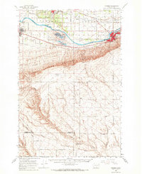
1965 · Prosser
USGS Topo · 1:62,500