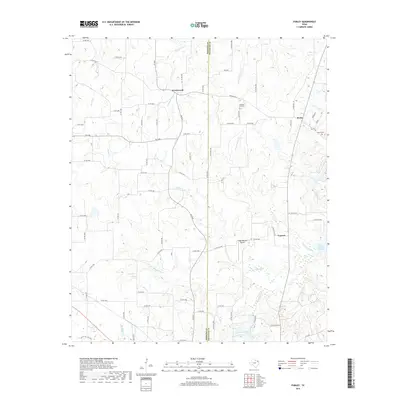
2019 Map of Purley
USGS Topo · Published 2019About this map
Greenwood and Purley anchor the upper reaches of this East Texas survey, where the landscape is defined by the winding tributaries of the Big Cypress Cr system. The terrain transitions from rural farmsteads and narrow county roads in the north to significant water features in the south, notably the eastern edges of Lake Franklin and the sprawling Lake Cypress Springs. These reservoirs, managed for regional water needs, sit amidst a network of smaller drainages like Coon Cr and Little Cypress Cr. Local history is preserved in sites such as Pleasant Hill Cem and Liberty Cem, while the Foggy Bottom Airport suggests the modern utility of these open spaces. The boundary between Hopkins and Franklin counties bisects the map, illustrating how political lines cut through the natural watershed and the small communities of Cypress and surrounding timberlands.
Find a feature on this map
85 named features on this map. Tap any name to fly to it.
Don’t see what you’re looking for? This feature index may not catch every label — zoom into the map to look around manually.
Map Details
Editions of this 2019 Purley Map
This is the sole edition of this map. No revisions or reprints were ever made.
Other maps of this area

1953 · Texarkana
USGS Topo · 1:250,000

1956 · Texarkana
USGS Topo · 1:250,000

1956 · Tyler
USGS Topo · 1:250,000

1960 · Winnsboro
USGS Topo · 1:24,000

1960 · Newsome
USGS Topo · 1:24,000

1960 · Pleasant Grove
USGS Topo · 1:24,000

1964 · Mount Vernon
USGS Topo · 1:24,000

1964 · Saltillo
USGS Topo · 1:24,000

1964 · Como
USGS Topo · 1:24,000

1964 · Purley
USGS Topo · 1:24,000