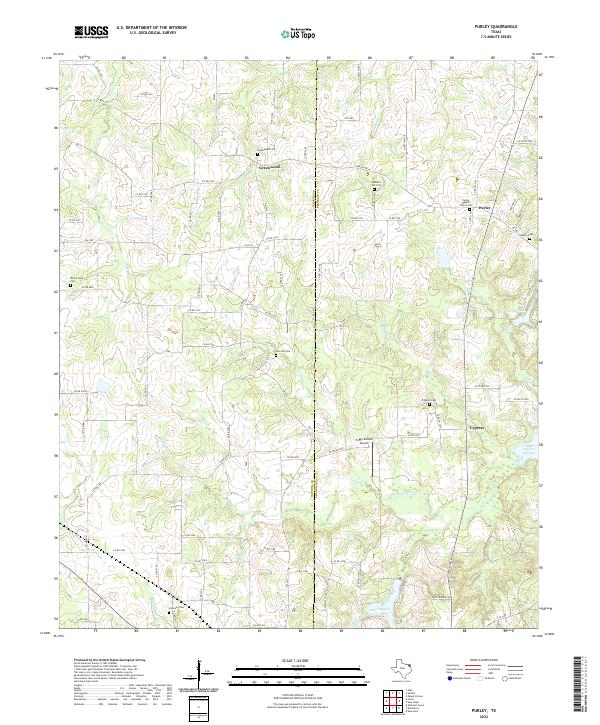
2022 Map of Purley
USGS Topo · Published 2022About this map
The Hopkins and Franklin County line bisects this region of Northeast Texas, where the landscape is defined by the headwaters of the Cypress Creek basin. The small community of Purley serves as a local hub near the eastern edge, anchored by the Purley Baptist Church and its accompanying Purley Baptist Church Cem. A dense network of rural routes, including Farm Rd 900 W and FM 3105, connects numerous family and community burial grounds such as Greenwood Cem, Liberty Cem, and Pine Hill Cem, suggesting a long-established pattern of small-plot farming and kinship networks.
Find a feature on this map
90 named features on this map. Tap any name to fly to it.
Don’t see what you’re looking for? This feature index may not catch every label — zoom into the map to look around manually.
Map Details
Editions of this 2022 Purley Map
This is the sole edition of this map. No revisions or reprints were ever made.
Other maps of this area

1953 · Texarkana
USGS Topo · 1:250,000

1956 · Texarkana
USGS Topo · 1:250,000

1956 · Tyler
USGS Topo · 1:250,000

1960 · Winnsboro
USGS Topo · 1:24,000

1960 · Newsome
USGS Topo · 1:24,000

1960 · Pleasant Grove
USGS Topo · 1:24,000

1964 · Mount Vernon
USGS Topo · 1:24,000

1964 · Saltillo
USGS Topo · 1:24,000

1964 · Como
USGS Topo · 1:24,000

1964 · Purley
USGS Topo · 1:24,000