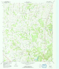
1964 Map of Purley
USGS Topo · Published 1992About this map
Greenwood and Purley anchor this rural landscape in East Texas, where the terrain is defined by a dense network of tributaries feeding into Big Cypress Creek. Mapped in 1964, the area shows a clear transition from agricultural settlements to early industrial activity, particularly evident in the Oil Wells scattered near Harmony and the presence of a Gravel Pit and Sandpit. Small communities like Morris Grove and Winterfield are documented alongside family and community landmarks such as Pleasant Hill Cem and Liberty Cem, providing essential data points for local genealogists. The eastern border is defined by the Hopkins Co Franklin Co line, with the southern reaches showcasing the waters of Lake Franklin. This survey preserves the exact locations of many named creek systems, including Huggins Creek and Caney Creek, which shaped the early development and property lines of these Texas counties.
Find a feature on this map
37 named features on this map. Tap any name to fly to it.
Don’t see what you’re looking for? This feature index may not catch every label — zoom into the map to look around manually.
Map Details
Editions of this 1964 Purley Map
2 editions found
Other maps of this area

1953 · Texarkana
USGS Topo · 1:250,000

1956 · Texarkana
USGS Topo · 1:250,000

1956 · Tyler
USGS Topo · 1:250,000

1960 · Winnsboro
USGS Topo · 1:24,000

1960 · Newsome
USGS Topo · 1:24,000

1960 · Pleasant Grove
USGS Topo · 1:24,000

1964 · Mount Vernon
USGS Topo · 1:24,000

1964 · Saltillo
USGS Topo · 1:24,000

1964 · Como
USGS Topo · 1:24,000

1964 · Purley
USGS Topo · 1:24,000