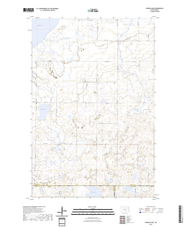
2024 Map of Pursian Lake
USGS Topo · Published 2024About this map
Long Lake National Wildlife Refuge dominates the northwestern corner of this landscape, marking a significant conservation corridor in the Missouri Coteau region. The area is defined by a dense network of glacial potholes and alkaline basins, including Pursian Lake and the aptly named Stink Lake further south. This map captures the section lines and rural infrastructure at the triple junction of Kidder, Emmons, and Logan counties, where the high concentration of wetlands is preserved through the Kidder County Waterfowl Production Area and the Emmons County Waterfowl Production Area. A singular historic anchor, the Bethel Cem, sits along 50th St SE, providing a vital touchpoint for genealogists researching the early homesteading families of this prairie region. The grid of gravel roads like 24th Ave SE and 48th St SE provides a window into the enduring agricultural layout of central North Dakota.
Find a feature on this map
32 named features on this map. Tap any name to fly to it.
Don’t see what you’re looking for? This feature index may not catch every label — zoom into the map to look around manually.
Map Details
Editions of this 2024 Pursian Lake Map
This is the sole edition of this map. No revisions or reprints were ever made.
Other maps of this area

1951 · Driscoll
USGS Topo · 1:62,500

1952 · Dawson
USGS Topo · 1:24,000

1952 · Steele
USGS Topo · 1:24,000

1953 · Jamestown
USGS Topo · 1:250,000

1954 · Bismarck
USGS Topo · 1:250,000

1956 · Jamestown
USGS Topo · 1:250,000

1958 · Bismarck
USGS Topo · 1:250,000

1975 · Lake Geneva
USGS Topo · 1:24,000

1975 · Braddock
USGS Topo · 1:24,000
1975 · Braddock NE
USGS Topo · 1:24,000