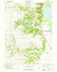
1972 Map of Putnam
USGS Topo · Published 1974About this map
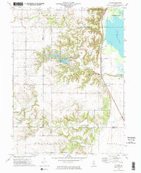
Lake Thunderbird dominates the central landscape of this Illinois river valley region, surrounded by the intricate drainages of Senachwine Creek and Crow Creek. The small settlement of Putnam is situated along the Chicago Rock Island and Pacific railroad line, which skirts the edge of the Illinois River floodplain. This low-lying eastern terrain is marked by Goose Lake and Senachwine Lake, highlighting the area's rich riparian environment.
Find a feature on this map
24 named features on this map. Tap any name to fly to it.
Don’t see what you’re looking for? This feature index may not catch every label — zoom into the map to look around manually.
Map Details
Editions of this 1972 Putnam Map
2 editions found
Other maps of this area

1893 · Lacon
USGS Topo · 1:62,500

1893 · Hennepin
USGS Topo · 1:62,500

1909 · Hennepin
USGS Topo · 1:62,500

1911 · Hennepin
USGS Topo · 1:62,500

1921 · Buda
USGS Topo · 1:62,500

1923 · Buda
USGS Topo · 1:62,500

1933 · Lacon
USGS Topo · 1:62,500

1933 · Camp Grove
USGS Topo · 1:48,000

1937 · Lacon
USGS Topo · 1:62,500

1945 · Bradford
USGS Topo · 1:62,500