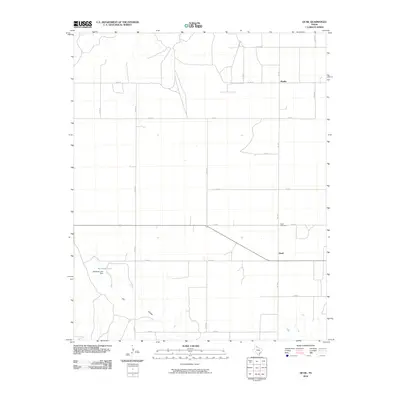
2010 Map of Quail
USGS Topo · Published 2010About this map
Quail and the northern settlement of Marilla anchor this section of the Texas Panhandle, defined by a rigid grid of agricultural roads. The landscape is marked by the presence of McIntosh Lake and the associated McIntosh Lake Dam in the southwest, while the drainages of Dry Hollow cut through the terrain. A network of county routes, including Co RD 90 and Co RD 40, intersect with FM 1547, illustrating the rural infrastructure required for the region's farming and ranching operations. Genealogists will find the Quail Cemetery north of the main townsite particularly noteworthy. The map reveals the precise layout of the panhandle prairie, where every mile is accounted for by the intersection of numbered county roads and state farm-to-market routes.
Find a feature on this map
21 named features on this map. Tap any name to fly to it.
Don’t see what you’re looking for? This feature index may not catch every label — zoom into the map to look around manually.
Map Details
Editions of this 2010 Quail Map
This is the sole edition of this map. No revisions or reprints were ever made.
Other maps of this area

1954 · Amarillo
USGS Topo · 1:250,000

1954 · Plainview
USGS Topo · 1:250,000

1958 · Amarillo
USGS Topo · 1:250,000

1958 · Plainview
USGS Topo · 1:250,000

1959 · Spencer Lake
USGS Topo · 1:24,000

1959 · McKnight
USGS Topo · 1:24,000

1963 · Giles
USGS Topo · 1:24,000

1964 · Rolla SW
USGS Topo · 1:24,000

1964 · Rolla NE
USGS Topo · 1:24,000

1964 · Quail
USGS Topo · 1:24,000