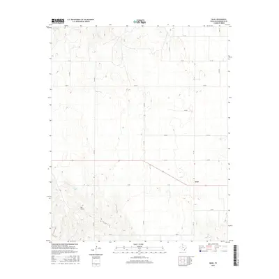
2016 Map of Quail
USGS Topo · Published 2016About this map
Quail serves as the primary settlement within this section of Collingsworth County, situated at the intersection of FM 1547 and local thoroughfares. The landscape is defined by the agricultural grid typical of the Texas Panhandle, with a dense network of county roads such as Co Rd 40 and Co Rd 60 providing access to the surrounding plains. To the southwest, the terrain transitions into the subtle drainage patterns of Dry Hollow and the localized basin of McIntosh Lake. This 2016 survey, produced by the U.S. Geological Survey using NAIP imagery and GNIS data, provides a clear view of the rural infrastructure and land management patterns of the modern era. The spatial arrangement of the farm-to-market roads and the concentration of structures in Quail highlight the enduring layout of this high plains community.
Find a feature on this map
19 named features on this map. Tap any name to fly to it.
Don’t see what you’re looking for? This feature index may not catch every label — zoom into the map to look around manually.
Map Details
Editions of this 2016 Quail Map
This is the sole edition of this map. No revisions or reprints were ever made.
Other maps of this area

1954 · Amarillo
USGS Topo · 1:250,000

1954 · Plainview
USGS Topo · 1:250,000

1958 · Amarillo
USGS Topo · 1:250,000

1958 · Plainview
USGS Topo · 1:250,000

1959 · Spencer Lake
USGS Topo · 1:24,000

1959 · McKnight
USGS Topo · 1:24,000

1963 · Giles
USGS Topo · 1:24,000

1964 · Rolla SW
USGS Topo · 1:24,000

1964 · Rolla NE
USGS Topo · 1:24,000

1964 · Quail
USGS Topo · 1:24,000