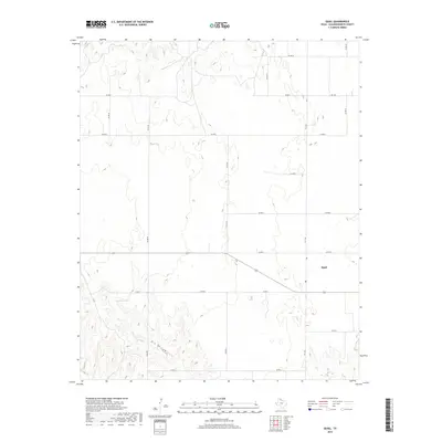
2019 Map of Quail
USGS Topo · Published 2019About this map
Quail is situated in the high plains of Collingsworth County, appearing here as a focused rural hub amidst an expansive agricultural landscape. The settlement is defined by the intersection of several local routes, including Fm 1547 and a network of county roads like Co Rd S and Co Rd Q that divide the terrain into large sections. North of the community, the topography is relatively level, while to the south and west, the land becomes more textured by drainage features. Notable landmarks include the seasonal waters of McIntosh Lake and the natural depression of Dry Hollow, which cuts across the southwestern portion of the sheet. This survey provides a precise look at the rural infrastructure of the Texas Panhandle, documenting the precise layout of ranch roads and water catchments that support the local cattle and farming operations.
Find a feature on this map
19 named features on this map. Tap any name to fly to it.
Don’t see what you’re looking for? This feature index may not catch every label — zoom into the map to look around manually.
Map Details
Editions of this 2019 Quail Map
This is the sole edition of this map. No revisions or reprints were ever made.
Other maps of this area

1954 · Amarillo
USGS Topo · 1:250,000

1954 · Plainview
USGS Topo · 1:250,000

1958 · Amarillo
USGS Topo · 1:250,000

1958 · Plainview
USGS Topo · 1:250,000

1959 · Spencer Lake
USGS Topo · 1:24,000

1959 · McKnight
USGS Topo · 1:24,000

1963 · Giles
USGS Topo · 1:24,000

1964 · Rolla SW
USGS Topo · 1:24,000

1964 · Rolla NE
USGS Topo · 1:24,000

1964 · Quail
USGS Topo · 1:24,000