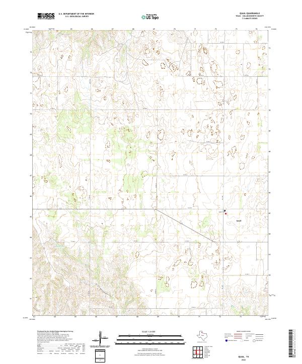
2022 Map of Quail
USGS Topo · Published 2022About this map
The small community of Quail serves as the focal point of this Panhandle landscape, where the agricultural grid is defined by a dense network of farm-to-market roads and county routes. Settled within Collingsworth County, the area's history is preserved at the Quail Cem located just north of the town center. The terrain is characterized by subtle drainage patterns, most notably the seasonal Dry Hollow and the waters of McIntosh Lake to the west. This 2022 survey documents the contemporary rural infrastructure, including FM 1547 and FM 1981, illustrating how modern transportation follows the established section lines of the Texas plains. The map provides a clear record for genealogists and local historians tracing family holdings or the footprint of this quiet ranching and farming region.
Find a feature on this map
20 named features on this map. Tap any name to fly to it.
Don’t see what you’re looking for? This feature index may not catch every label — zoom into the map to look around manually.
Map Details
Editions of this 2022 Quail Map
This is the sole edition of this map. No revisions or reprints were ever made.
Other maps of this area

1954 · Amarillo
USGS Topo · 1:250,000

1954 · Plainview
USGS Topo · 1:250,000

1958 · Amarillo
USGS Topo · 1:250,000

1958 · Plainview
USGS Topo · 1:250,000

1959 · Spencer Lake
USGS Topo · 1:24,000

1959 · McKnight
USGS Topo · 1:24,000

1963 · Giles
USGS Topo · 1:24,000

1964 · Rolla SW
USGS Topo · 1:24,000

1964 · Rolla NE
USGS Topo · 1:24,000

1964 · Quail
USGS Topo · 1:24,000