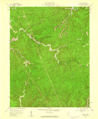
1958 Map of Quick
USGS Topo · Published 1959About this map
Blue Creek winds through the northern portion of this Kanawha County landscape, anchoring the village of Quick and nearby Coalridge during the late 1950s. The region is defined by a dense network of hollows and forks, where small settlements like Cinco, Blount, and Rensford developed along the narrow valley floors of Fivemile Creek and Campbells Creek. This era of the West Virginia coalfields is marked by a mix of extraction and infrastructure, with several Mine locations and a Pumping Station situated near the headwaters of Little Tenmile Fork.
Find a feature on this map
54 named features on this map. Tap any name to fly to it.
Don’t see what you’re looking for? This feature index may not catch every label — zoom into the map to look around manually.
Map Details
Editions of this 1958 Quick Map
4 editions found
Other maps of this area

1897 · Kanawha Falls
USGS Topo · 1:125,000

1899 · Charleston
USGS Topo · 1:125,000

1900 · Kanawha Falls
USGS Topo · 1:125,000

1901 · Kanawha Falls
USGS Topo · 1:125,000

1907 · Clendenin
USGS Topo · 1:62,500

1908 · Montgomery
USGS Topo · 1:48,000

1909 · Charleston
USGS Topo · 1:62,500

1909 · Clendenin
USGS Topo · 1:62,500

1909 · Peytona
USGS Topo · 1:48,000

1910 · Montgomery
USGS Topo · 1:62,500