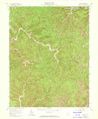
1958 Map of Quick
USGS Topo · Published 1973About this map
Quick and Coalridge anchor the northern reaches of this Kanawha County landscape, where the steep topography of Elk, Malden, and Cabin Creek dictates the pattern of mid-century settlement. Numerous hollows and forks carve through the terrain, with small communities like Cinco, Blount, and Rensford established along the narrow valley floors. The presence of a Lookout Tower and multiple schools, including Pointlick Sch, Hansel Sch, and Tenmile Sch, underscores the infrastructure serving these isolated rural areas.
Find a feature on this map
47 named features on this map. Tap any name to fly to it.
Don’t see what you’re looking for? This feature index may not catch every label — zoom into the map to look around manually.
Map Details
Editions of this 1958 Quick Map
4 editions found
Other maps of this area

1897 · Kanawha Falls
USGS Topo · 1:125,000

1899 · Charleston
USGS Topo · 1:125,000

1900 · Kanawha Falls
USGS Topo · 1:125,000

1901 · Kanawha Falls
USGS Topo · 1:125,000

1907 · Clendenin
USGS Topo · 1:62,500

1908 · Montgomery
USGS Topo · 1:48,000

1909 · Charleston
USGS Topo · 1:62,500

1909 · Clendenin
USGS Topo · 1:62,500

1909 · Peytona
USGS Topo · 1:48,000

1910 · Montgomery
USGS Topo · 1:62,500