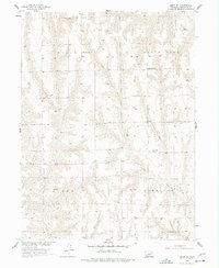
1956 Map of Quick NE
USGS Topo · Published 1977About this map
Coon Creek winds through the dissected loess plains of Frontier County in the mid-1950s, a landscape defined by its rural township structure and the persistence of the country school system. The map documents a network of local landmarks essential to mid-century rural life, including Ash Grove Sch in Lincoln and South Star Sch in North Star. Genealogists will find particular value in the location of Schoonover Cem, located near the intersection of the Allen and Harrison boundaries. This survey was conducted as part of the Department of the Interior program for the development of the Missouri River Basin, reflecting an era of systematic topographic documentation in Nebraska.
Find a feature on this map
9 named features on this map. Tap any name to fly to it.
Don’t see what you’re looking for? This feature index may not catch every label — zoom into the map to look around manually.
Map Details
Editions of this 1956 Quick NE Map
2 editions found
Other maps of this area

1902 · Gothenburg
USGS Topo · 1:125,000

1954 · McCook
USGS Topo · 1:250,000

1956 · Curtis SW
USGS Topo · 1:24,000

1956 · Quick NE
USGS Topo · 1:24,000

1956 · Curtis SE
USGS Topo · 1:24,000

1956 · Stockville
USGS Topo · 1:24,000

1956 · Bartley NW
USGS Topo · 1:24,000

1957 · McCook
USGS Topo · 1:250,000

1958 · McCook
USGS Topo · 1:250,000

1970 · Red Willow Dam
USGS Topo · 1:24,000