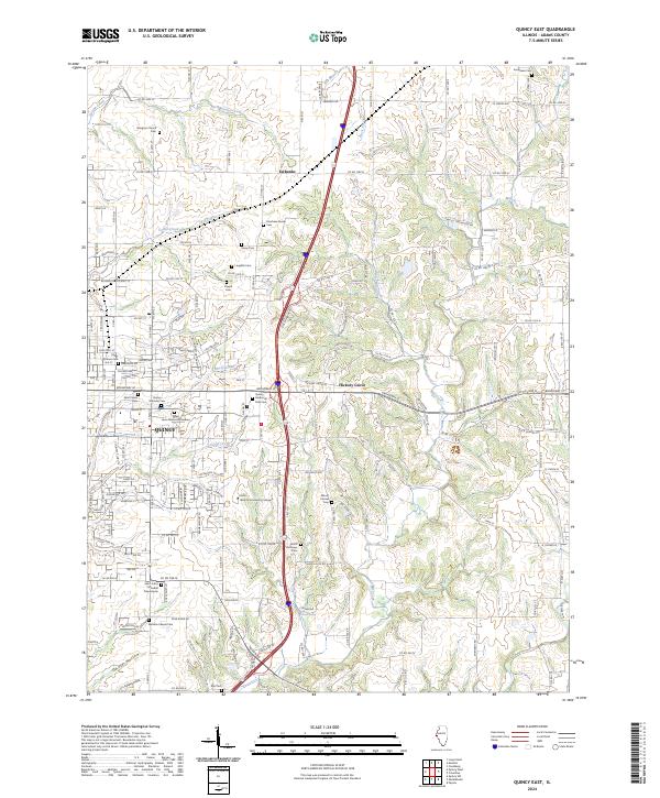
2024 Map of Quincy East
USGS Topo · Published 2024About this map
Quincy expands eastward in this modern survey, revealing a landscape where urban development meets the deep-cut drainage of the Mississippi River basin. The map records a dense concentration of commemorative and civic sites, including the Quincy National Cem, Forest Lawn Memorial Gardens, and the Quincy Memorial Park Cem. These sites, alongside smaller family plots like the Voorhees Family Cem and Laughlin Cem, offer significant data for genealogical research in Adams County.
Find a feature on this map
158 named features on this map. Tap any name to fly to it.
Don’t see what you’re looking for? This feature index may not catch every label — zoom into the map to look around manually.
Map Details
Editions of this 2024 Quincy East Map
This is the sole edition of this map. No revisions or reprints were ever made.
Other maps of this area

1925 · Quincy
USGS Topo · 1:62,500

1925 · Liberty
USGS Topo · 1:62,500

1927 · Liberty
USGS Topo · 1:62,500

1944 · Quincy
USGS Topo · 1:62,500

1945 · Quincy
USGS Topo · 1:62,500

1946 · Mendon
USGS Topo · 1:62,500

1948 · Quincy
USGS Topo · 1:250,000

1948 · Mendon
USGS Topo · 1:62,500

1948 · Camp Point
USGS Topo · 1:62,500

1956 · Quincy
USGS Topo · 1:250,000