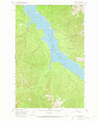
1958 Map of Quintonkon
USGS Topo · Published 1973About this map
Hungry Horse Reservoir dominates the center of this landscape, flooding the valley of the South Fork Flathead River as it passes through the Flathead National Forest. This 1958 field-checked survey reveals the area's transition into a managed wilderness and recreational zone following the completion of the dam downstream. The small settlement at Quintonkon sits near the confluence of Quintonkon Creek and Sullivan Creek, while evidence of geologic exploration remains at the Core Drill Holes near the water's edge. The terrain is marked by steep ridges and peaks such as Prospector Mountain and Battery Mountain, connected by primitive infrastructure like the Baptiste Creek Trail and Pack Trail. Remote outposts like Devils Corkscrew Campground and Peters Creek Campground illustrate the mid-century development of backcountry access in the Montana Rockies.
Find a feature on this map
33 named features on this map. Tap any name to fly to it.
Don’t see what you’re looking for? This feature index may not catch every label — zoom into the map to look around manually.
Map Details
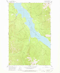
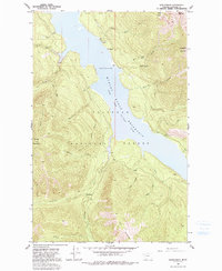
Editions of this 1958 Quintonkon Map
4 editions found
Other maps of this area

1914 · Nyack
USGS Topo · 1:125,000

1955 · Choteau
USGS Topo · 1:250,000

1957 · Choteau
USGS Topo · 1:250,000

1958 · Choteau
USGS Topo · 1:250,000

1958 · Circus Peak
USGS Topo · 1:24,000

1958 · Nimrod
USGS Topo · 1:24,000

1958 · Quintonkon
USGS Topo · 1:24,000

1958 · Felix Peak
USGS Topo · 1:24,000

1960 · Cut Bank
USGS Topo · 1:250,000

1962 · Choteau
USGS Topo · 1:250,000