
1958 Map of Quintonkon
USGS Topo · Published 1978About this map
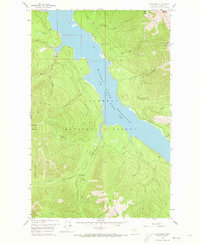
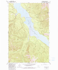
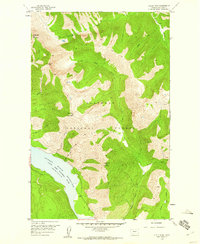
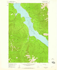
Hungry Horse Reservoir South Fork Flathead River dominates the central landscape of this mountain wilderness within the Flathead National Forest. This mid-century survey captures the region following the reservoir's creation, showing the flooded canyons where numerous drainages like Devils Corkscrew Creek and Baptiste Creek now meet the pool. A poignant local landmark, the Baptiste Grave, remains marked on the eastern slopes near Hoke Creek, while remote Pack Trails provide the only access through the steep terrain surrounding Battery Mountain and Prospector Mountain. Evidence of geological exploration is noted via Core Drill Holes near the reservoir's edge, reflecting the industrial interests that shaped the valley. The map serves as a record of the backcountry before modern recreation dominated, highlighting isolated spots like Devils Corkscrew Campground and Peters Creek Campground.
Find a feature on this map
30 named features on this map. Tap any name to fly to it.
Don’t see what you’re looking for? This feature index may not catch every label — zoom into the map to look around manually.
Map Details
Editions of this 1958 Quintonkon Map
4 editions found
Other maps of this area

1914 · Nyack
USGS Topo · 1:125,000

1955 · Choteau
USGS Topo · 1:250,000

1957 · Choteau
USGS Topo · 1:250,000

1958 · Choteau
USGS Topo · 1:250,000
1958 · Circus Peak
USGS Topo · 1:24,000
1958 · Nimrod
USGS Topo · 1:24,000
1958 · Quintonkon
USGS Topo · 1:24,000
1958 · Felix Peak
USGS Topo · 1:24,000

1960 · Cut Bank
USGS Topo · 1:250,000

1962 · Choteau
USGS Topo · 1:250,000