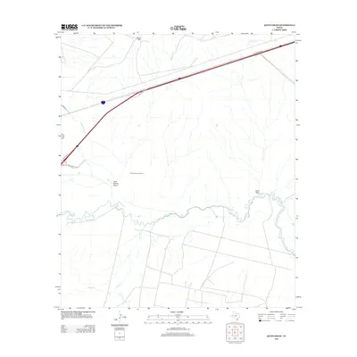
2012 Map of Quito Draw
USGS Topo · Published 2012About this map
Scott Delaware Oil Field and the meandering Pecos River define this West Texas landscape in the early 21st century. The terrain is characterized by ephemeral drainages and intermittent water management, seen where the Main Line Canal cuts through the western portion of the sheet. Modern transportation infrastructure is prominent, with W Interstate 20 and Ranch Road 516 providing access to the energy extraction sites and cattle country. Significant relief is found at Hays Hill in the north, while the southern portion transitions into the drainage basin for Toyah Cr and the namesake Quito Draw. The map illustrates the industrial footprint of petroleum exploration upon a traditional ranching environment.
Find a feature on this map
12 named features on this map. Tap any name to fly to it.
Don’t see what you’re looking for? This feature index may not catch every label — zoom into the map to look around manually.
Map Details
Editions of this 2012 Quito Draw Map
This is the sole edition of this map. No revisions or reprints were ever made.
Other maps of this area

1931 · Barstow
USGS Topo · 1:125,000

1954 · Pecos
USGS Topo · 1:250,000

1957 · Pecos
USGS Topo · 1:250,000

1961 · Soda Lake
USGS Topo · 1:24,000

1963 · Ligon Ranch
USGS Topo · 1:24,000

1963 · Old X Ranch
USGS Topo · 1:24,000

1963 · Quito Draw
USGS Topo · 1:24,000

1963 · China Lake
USGS Topo · 1:24,000

1963 · Pecos East
USGS Topo · 1:24,000

1963 · Toyah Lake
USGS Topo · 1:24,000