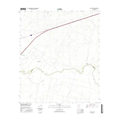
2016 Map of Quito Draw
USGS Topo · Published 2016About this map
The Pecos River snakes across this West Texas landscape, serving as the natural boundary where Ward Co and Reeves Co meet. This 2016 survey highlights a region defined by its water management and arid drainage patterns, featuring the Main Line Canal and the Barstow Water Tank. The terrain is marked by significant topographical depressions such as Rock Quarry Draw and the eponymous Quito Draw, which channel seasonal runoff toward the river. Transportation corridors like Ranch Rd 516 and the Interstate 20 frontage, labeled as I-20-S-SVC-RD, provide the primary access through this sparsely settled territory. Natural elevations such as Hays Hill and the winding course of Toyah Cr further define the landscape's character south of the river.
Find a feature on this map
11 named features on this map. Tap any name to fly to it.
Don’t see what you’re looking for? This feature index may not catch every label — zoom into the map to look around manually.
Map Details
Editions of this 2016 Quito Draw Map
This is the sole edition of this map. No revisions or reprints were ever made.
Other maps of this area

1931 · Barstow
USGS Topo · 1:125,000

1954 · Pecos
USGS Topo · 1:250,000

1957 · Pecos
USGS Topo · 1:250,000

1961 · Soda Lake
USGS Topo · 1:24,000

1963 · Ligon Ranch
USGS Topo · 1:24,000

1963 · Old X Ranch
USGS Topo · 1:24,000

1963 · Quito Draw
USGS Topo · 1:24,000

1963 · China Lake
USGS Topo · 1:24,000

1963 · Pecos East
USGS Topo · 1:24,000

1963 · Toyah Lake
USGS Topo · 1:24,000