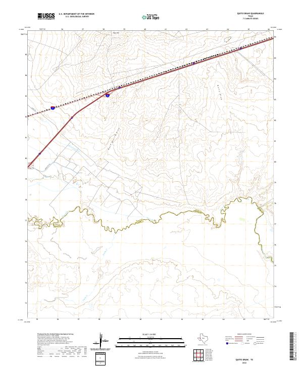
2022 Map of Quito Draw
USGS Topo · Published 2022About this map
The Pecos River serves as the primary geographic marker here, delineating the winding boundary between Ward and Reeves counties. This arid landscape is defined by its complex drainage network, where the Quito Draw and Rock Quarry Draw channel seasonal runoff toward the river. Human modification of the water table is evident through the presence of the Main Line Canal, which cuts through the terrain to support regional irrigation and agriculture. To the north, the topographic relief is punctuated by Hays Hill, providing a vantage point over the intersection of modern transit corridors and ancient natural waterways. The southern portion of the map is dominated by the sprawling floodplain of Toyah Cr, where it approaches its confluence with the Pecos, illustrating the vital role of these intermittent streams in the West Texas environment.
Find a feature on this map
9 named features on this map. Tap any name to fly to it.
Don’t see what you’re looking for? This feature index may not catch every label — zoom into the map to look around manually.
Map Details
Editions of this 2022 Quito Draw Map
This is the sole edition of this map. No revisions or reprints were ever made.
Other maps of this area

1931 · Barstow
USGS Topo · 1:125,000

1954 · Pecos
USGS Topo · 1:250,000

1957 · Pecos
USGS Topo · 1:250,000

1961 · Soda Lake
USGS Topo · 1:24,000

1963 · Ligon Ranch
USGS Topo · 1:24,000

1963 · Old X Ranch
USGS Topo · 1:24,000

1963 · Quito Draw
USGS Topo · 1:24,000

1963 · China Lake
USGS Topo · 1:24,000

1963 · Pecos East
USGS Topo · 1:24,000

1963 · Toyah Lake
USGS Topo · 1:24,000