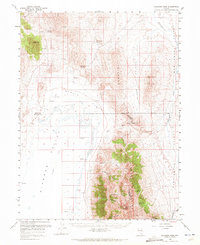
1959 Map of Railroad Pass
USGS Topo · Published 1972About this map
Diamond Mountains dominate the central topography of this Great Basin landscape, forming a high ridge that separates Diamond Valley from the Huntington Creek drainage. In the late 1950s, this region served as a junction for three Nevada counties, with White Pine, Elko, and Eureka boundaries meeting near the strategic Railroad Pass. The terrain transitions from the stark Diamond Alkali Flat in the west to high peaks like Diamond Peak and Black Mountain in the north.
Find a feature on this map
27 named features on this map. Tap any name to fly to it.
Don’t see what you’re looking for? This feature index may not catch every label — zoom into the map to look around manually.
Map Details
Editions of this 1959 Railroad Pass Map
2 editions found

Other maps of this area

1926 · Roberts Mountains
USGS Topo · 1:250,000

1929 · Roberts Mountains
USGS Topo · 1:250,000

1934 · Jiggs
USGS Topo · 1:125,000

1937 · Mineral Hill
USGS Topo · 1:48,000

1937 · Jiggs
USGS Topo · 1:125,000

1943 · Mineral Hill
USGS Topo · 1:62,500

1949 · Garden Valley
USGS Topo · 1:62,500

1951 · Garden Valley
USGS Topo · 1:62,500

1952 · Pine Valley
USGS Topo · 1:62,500

1955 · Millett
USGS Topo · 1:250,000