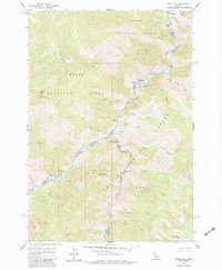
1962 Map of Ramey Hill
USGS Topo · Published 1983About this map
The Middle Fork Salmon River carves a deep path through this remote mountainous landscape at the confluence of the Salmon, Boise, and Challis National Forests. Based on field checks from 1962, the map documents a specialized backcountry economy centered on aviation and hot springs. The Simplot Airstrip and Simplot Campground sit at a strategic point near the river's bend, while the Tappen Ranch remains a notable outpost in the north.
Find a feature on this map
45 named features on this map. Tap any name to fly to it.
Don’t see what you’re looking for? This feature index may not catch every label — zoom into the map to look around manually.
Map Details
Editions of this 1962 Ramey Hill Map
3 editions found
Other maps of this area

1930 · Casto
USGS Topo · 1:125,000

1957 · Challis
USGS Topo · 1:250,000

1960 · Challis
USGS Topo · 1:250,000

1962 · Bear Creek Point
USGS Topo · 1:24,000

1962 · Norton Ridge
USGS Topo · 1:24,000

1962 · Shellrock Peak
USGS Topo · 1:24,000

1962 · Ramey Hill
USGS Topo · 1:24,000

1963 · Challis
USGS Topo · 1:250,000

1963 · Rock Creek
USGS Topo · 1:24,000
1963 · Aparejo Point
USGS Topo · 1:24,000