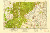
1958 Map of Raton
USGS Topo · Published 1958About this map
The Sangre de Cristo Mountains dominate this mid-century landscape, rising to Wheeler Peak 13160 and shaping the settlement patterns of north-central New Mexico. To the west, traditional communities such as Arroyo Seco and Ranchos de Taos sit near the winding Rio Grande. The map clearly delineates the vast extent of the Maxwell Grant, a massive land holding that covers a significant portion of the high plains east of the Cimarron Range.
Find a feature on this map
103 named features on this map. Tap any name to fly to it.
Don’t see what you’re looking for? This feature index may not catch every label — zoom into the map to look around manually.
Map Details
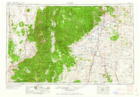
Editions of this 1958 Raton Map
3 editions found

Other maps of this area

1889 · Las Vegas
USGS Topo · 1:125,000

1889 · Santa Fe
USGS Topo · 1:125,000

1891 · Las Vegas
USGS Topo · 1:125,000

1891 · Spanish Peaks
USGS Topo · 1:125,000

1891 · Mesa De Maya
USGS Topo · 1:125,000

1892 · Santa Clara
USGS Topo · 1:125,000

1892 · Watrous
USGS Topo · 1:125,000

1892 · Elmoro
USGS Topo · 1:125,000

1893 · Spanish Peaks
USGS Topo · 1:125,000

1893 · Las Vegas
USGS Topo · 1:125,000