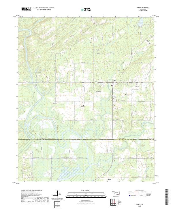
2022 Map of Rattan
USGS Topo · Published 2022About this map
The Kiamichi River winds through the western half of this landscape, carving a valley that separates the rural settlements of Belzoni and Rattan. This region of Pushmataha County is defined by a network of local roads and historic trails such as Meeker Trl and Rattan Trl, which navigate the undulating terrain of Sleepy Hollow. The map reveals a community structured around small townships and family burial grounds, including the Belzoni Cem and Rattan Cem.
Find a feature on this map
73 named features on this map. Tap any name to fly to it.
Don’t see what you’re looking for? This feature index may not catch every label — zoom into the map to look around manually.
Map Details
Editions of this 2022 Rattan Map
This is the sole edition of this map. No revisions or reprints were ever made.
Other maps of this area

1901 · Antlers
USGS Topo · 1:125,000

1901 · Alikchi
USGS Topo · 1:125,000

1912 · Antlers
USGS Topo · 1:125,000

1925 · Antlers
USGS Topo · 1:125,000

1950 · Mcalester
USGS Topo · 1:250,000

1961 · Antlers East
USGS Topo · 1:24,000

1962 · McAlester
USGS Topo · 1:250,000

1965 · McAlester
USGS Topo · 1:250,000
1969 · Hugo
USGS Topo · 1:24,000

1971 · Spencerville
USGS Topo · 1:24,000