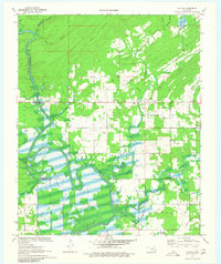
1971 Map of Rattan
USGS Topo · Published 1980About this map
The Kiamichi River defines the landscape of southeastern Oklahoma in the early 1970s, carving a winding path through the borderlands of Pushmataha and Choctaw Counties. This survey illustrates a rural region transitioning through water management projects, most notably the emergence of Hugo Lake and the Spillway at Lake Ozzie Cobb. The settlement at Rattan serves as a local hub, connected to the backwoods by the Rattan Trail and supported by local industry at various Gravel Pits. Genealogy researchers will find significant value in the mapped locations of Belzoni Cem and Rattan Cem, providing precise coordinates for family history research. The presence of a Gaging Station and numerous named tributaries like Big Waterhole Creek and Frazier Creek underscore the importance of the river system to the local economy and geography of the era.
Find a feature on this map
33 named features on this map. Tap any name to fly to it.
Don’t see what you’re looking for? This feature index may not catch every label — zoom into the map to look around manually.
Map Details
Editions of this 1971 Rattan Map
2 editions found
Other maps of this area

1901 · Antlers
USGS Topo · 1:125,000

1901 · Alikchi
USGS Topo · 1:125,000

1912 · Antlers
USGS Topo · 1:125,000

1925 · Antlers
USGS Topo · 1:125,000

1950 · Mcalester
USGS Topo · 1:250,000

1961 · Antlers East
USGS Topo · 1:24,000

1962 · McAlester
USGS Topo · 1:250,000

1965 · McAlester
USGS Topo · 1:250,000
1969 · Hugo
USGS Topo · 1:24,000

1971 · Spencerville
USGS Topo · 1:24,000