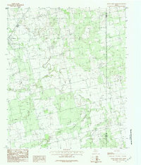
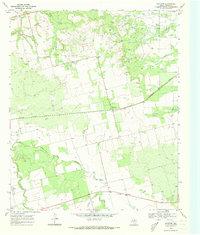
1984 Map of Raven Creek North
USGS Topo · Published 1984About this map
The town of Sylvester sits in the northwest corner of this West Texas survey, serving as the primary human settlement in a landscape dominated by the branching drainages of the Brazos River system. The Clear Fork Brazos River winds across the central portion of the map, fed by a network of seasonal watercourses including China Creek, East China Creek, and Dry Creek. These riparian corridors provide the primary structural detail in an area otherwise marked by wide-open ranching or agricultural land.
Find a feature on this map
8 named features on this map. Tap any name to fly to it.
Don’t see what you’re looking for? This feature index may not catch every label — zoom into the map to look around manually.
Map Details
Editions of this 1984 Raven Creek North Map
2 editions found
Other maps of this area

1893 · Roby
USGS Topo · 1:125,000

1931 · Rotan
USGS Topo · 1:62,500

1954 · Big Spring
USGS Topo · 1:250,000

1957 · Noodle
USGS Topo · 1:62,500

1958 · Big Spring
USGS Topo · 1:250,000
1965 · Neinda
USGS Topo · 1:24,000

1965 · McCaulley
USGS Topo · 1:24,000

1969 · Eskota
USGS Topo · 1:24,000
1969 · Longworth
USGS Topo · 1:24,000
1969 · Royston
USGS Topo · 1:24,000