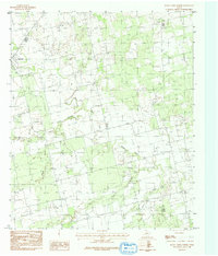
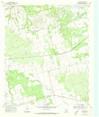
1984 Map of Raven Creek North
USGS Topo · Published 1992About this map
Sylvester stands as the primary settlement on this West Texas landscape, positioned in the northwest corner of a region defined by its complex drainage network. The Clear Fork Brazos River winds through the central portion of the quadrangle, joined by several significant tributaries including China Creek, East China Creek, and Dry Creek. These watercourses have carved out a topography of subtle draws and seasonal washes typical of the Rolling Plains.
Find a feature on this map
9 named features on this map. Tap any name to fly to it.
Don’t see what you’re looking for? This feature index may not catch every label — zoom into the map to look around manually.
Map Details
Editions of this 1984 Raven Creek North Map
2 editions found
Other maps of this area

1893 · Roby
USGS Topo · 1:125,000

1931 · Rotan
USGS Topo · 1:62,500

1954 · Big Spring
USGS Topo · 1:250,000

1957 · Noodle
USGS Topo · 1:62,500

1958 · Big Spring
USGS Topo · 1:250,000
1965 · Neinda
USGS Topo · 1:24,000

1965 · McCaulley
USGS Topo · 1:24,000

1969 · Eskota
USGS Topo · 1:24,000
1969 · Longworth
USGS Topo · 1:24,000
1969 · Royston
USGS Topo · 1:24,000