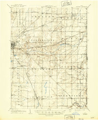
1908 Map of Ravenna
USGS Topo · Published 1946About this map
Ravenna serves as the central hub of Portage County during this early 20th-century survey, a period when the regional economy was defined by its dense network of steam railroads and rural township life. The Erie RR, Baltimore and Ohio RR, and the Cleveland and Pittsburgh RR intersect the landscape, creating vital transport junctions at places like Freedom Station and Rootstown Sta. This transit infrastructure supported numerous small agricultural hamlets such as Drakesburg and Atwater Center, which were anchored by a system of country schools including the distinctively named Whippoorwill School and Lime Ridge School. The Mahoning River and its various branches, such as Willow Creek, provided the natural drainage for a terrain increasingly etched with property lines and rural crossroads. For the genealogist, the map identifies specific post offices like Diamond PO and minor settlements like Angerburg that illustrate the fine-grained distribution of the local population before mid-century modernization.
Find a feature on this map
66 named features on this map. Tap any name to fly to it.
Don’t see what you’re looking for? This feature index may not catch every label — zoom into the map to look around manually.
Map Details
Editions of this 1908 Ravenna Map
2 editions found

Other maps of this area

1901 · Canton
USGS Topo · 1:62,500

1903 · Canton
USGS Topo · 1:62,500

1905 · Bristolville
USGS Topo · 1:62,500

1905 · Garrettsville
USGS Topo · 1:62,500

1906 · Kent
USGS Topo · 1:62,500

1906 · Chagrin Falls
USGS Topo · 1:62,500

1906 · Ravenna
USGS Topo · 1:62,500

1907 · Bristolville
USGS Topo · 1:62,500

1907 · Garrettsville
USGS Topo · 1:62,500

1908 · Warren
USGS Topo · 1:62,500