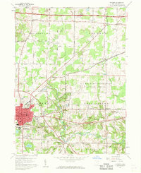
1960 Map of Ravenna
USGS Topo · Published 1961About this map
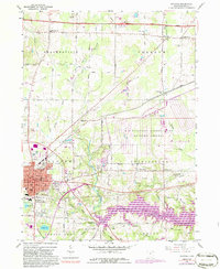
The city of Ravenna serves as the focal point for this 1960 survey, showing the intricate grid of the county seat as it expanded southward from the Baltimore and Ohio and Erie Lackawanna rail lines. To the east, the vast U S Military Reservation Ravenna Arsenal occupies a significant portion of the landscape, marked by a specialized network of roads and facilities. This industrial and military character contrasts with the rural townships of Shalersville, Freedom, and Charlestown, where land lines established by the private subdivision of the Connecticut Western Reserve are still clearly visible.
Find a feature on this map
54 named features on this map. Tap any name to fly to it.
Don’t see what you’re looking for? This feature index may not catch every label — zoom into the map to look around manually.
Map Details
Editions of this 1960 Ravenna Map
5 editions found
Other maps of this area

1905 · Garrettsville
USGS Topo · 1:62,500

1906 · Kent
USGS Topo · 1:62,500

1906 · Chagrin Falls
USGS Topo · 1:62,500

1906 · Ravenna
USGS Topo · 1:62,500

1907 · Garrettsville
USGS Topo · 1:62,500

1908 · Chagrin Falls
USGS Topo · 1:62,500

1908 · Ravenna
USGS Topo · 1:62,500

1950 · Cleveland
USGS Topo · 1:250,000

1953 · Aurora
USGS Topo · 1:24,000

1956 · Cleveland
USGS Topo · 1:250,000