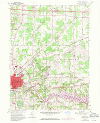
1960 Map of Ravenna
USGS Topo · Published 1971About this map
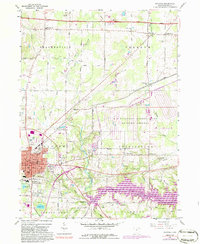
The city of Ravenna serves as a dense municipal core in this Portage County study, surrounded by the townships of Shalersville, Freedom, and Charlestown. The landscape is defined by massive infrastructure projects, notably the expansive Ravenna Arsenal U S Military Reservation and the West Branch Reservoir, which had recently altered the local hydrology. Local landmarks like Lake Rockwell and the Chestnut Hill Golf Course contrast with the industrial and transit corridors of the Ohio Turnpike and the Erie-Lackawanna rail lines.
Find a feature on this map
46 named features on this map. Tap any name to fly to it.
Don’t see what you’re looking for? This feature index may not catch every label — zoom into the map to look around manually.
Map Details
Editions of this 1960 Ravenna Map
5 editions found
Other maps of this area

1905 · Garrettsville
USGS Topo · 1:62,500

1906 · Kent
USGS Topo · 1:62,500

1906 · Chagrin Falls
USGS Topo · 1:62,500

1906 · Ravenna
USGS Topo · 1:62,500

1907 · Garrettsville
USGS Topo · 1:62,500

1908 · Chagrin Falls
USGS Topo · 1:62,500

1908 · Ravenna
USGS Topo · 1:62,500

1950 · Cleveland
USGS Topo · 1:250,000

1953 · Aurora
USGS Topo · 1:24,000

1956 · Cleveland
USGS Topo · 1:250,000