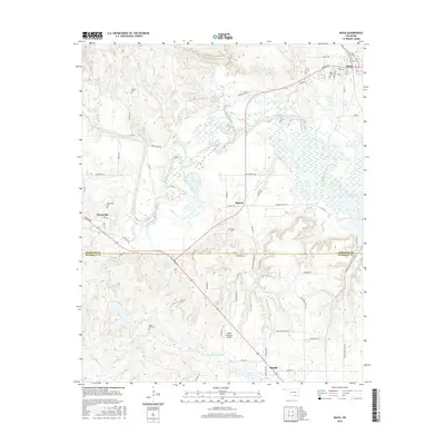
2016 Map of Ravia
USGS Topo · Published 2016About this map
The Washita River meanders through the heart of the Arbuckle Mountain foothills, shaping the border between Johnston and Marshall counties. This landscape is defined by its water resources, featuring numerous drainages like Sycamore Cr and Mill Creek, alongside modern developments such as the W M Chapman Reservoir and John O'Banion Reservoir. Local life centers around established towns such as Ravia, Russett, Mannsville, and the northern edge of Madill.
Find a feature on this map
64 named features on this map. Tap any name to fly to it.
Don’t see what you’re looking for? This feature index may not catch every label — zoom into the map to look around manually.
Map Details
Editions of this 2016 Ravia Map
This is the sole edition of this map. No revisions or reprints were ever made.
Other maps of this area

1901 · Tishomingo
USGS Topo · 1:125,000

1957 · Ardmore
USGS Topo · 1:250,000

1963 · Ardmore
USGS Topo · 1:250,000

1963 · Madill
USGS Topo · 1:24,000

1963 · Mannsville
USGS Topo · 1:24,000

1963 · Troy
USGS Topo · 1:24,000

1963 · Ravia
USGS Topo · 1:24,000

1963 · Mc Millan
USGS Topo · 1:24,000

1963 · Nebo
USGS Topo · 1:24,000
1967 · Tishomingo SW
USGS Topo · 1:24,000