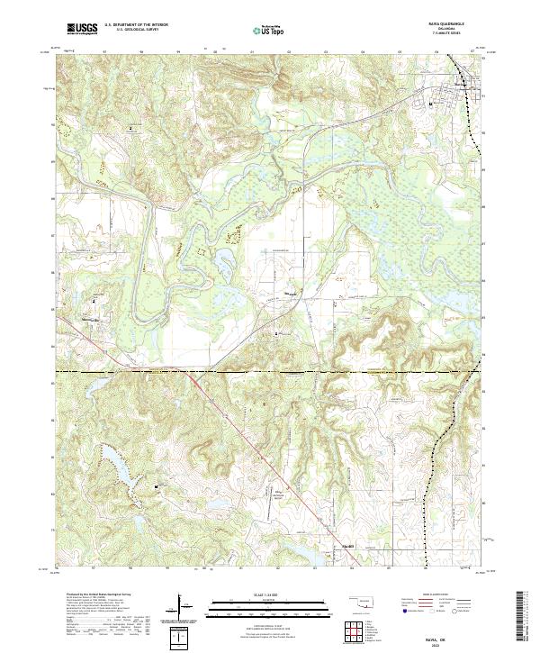
2022 Map of Ravia
USGS Topo · Published 2022About this map
The Washita River meanders through the heart of this landscape, defining the border between Johnston and Marshall counties. This agricultural and riverine region is anchored by the established settlements of Ravia, Russett, and Mannsville, each with its own local history preserved in sites like Ravia Cem and the Russett Cem. The terrain is deeply etched by a network of drainage systems, including Courtney Creek, Mill Creek, and Turkey Creek, which feed into the primary river valley. These waterways likely influenced the placement of early homesteads and the local road network that connects these rural communities. To the south, the expansion of modern infrastructure is evident near the outskirts of Madill, marked by the Madill Municipal Airport. Genealogists will find several family or community landmarks such as Norton Cem and Cedar Hill Cem, providing specific locations for tracing local ancestral roots.
Find a feature on this map
74 named features on this map. Tap any name to fly to it.
Don’t see what you’re looking for? This feature index may not catch every label — zoom into the map to look around manually.
Map Details
Editions of this 2022 Ravia Map
This is the sole edition of this map. No revisions or reprints were ever made.
Other maps of this area

1901 · Tishomingo
USGS Topo · 1:125,000

1957 · Ardmore
USGS Topo · 1:250,000

1963 · Ardmore
USGS Topo · 1:250,000

1963 · Madill
USGS Topo · 1:24,000

1963 · Mannsville
USGS Topo · 1:24,000

1963 · Troy
USGS Topo · 1:24,000

1963 · Ravia
USGS Topo · 1:24,000

1963 · Mc Millan
USGS Topo · 1:24,000

1963 · Nebo
USGS Topo · 1:24,000
1967 · Tishomingo SW
USGS Topo · 1:24,000