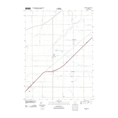
2010 Map of Rawson
USGS Topo · Published 2010About this map
Ottawa Creek and its various tributaries, such as Tiderishi Creek and Marsh Run, wind through this agricultural landscape in northwestern Ohio. The map captures the quiet configuration of small rural communities like Rawson, Mount Cory, and the crossroads at Cannonsburg. This area retains a strong connection to its 19th-century roots, evidenced by the numerous burial grounds marking the townships, including the Flick Cemetery in the north and the Schellbas Cemetery near the southern border. The transition of local infrastructure is visible in the proximity of the Bluffton Airport to the older grid of township roads. Civil services are centered at the Rawson Post Office and the Mount Corey Post Office, while the inclusion of landmarks like Ross Lake suggests the few exceptions to the prevailing farmland. This survey provides a clear view of the persistent rural settlements and family-named roads that characterize the region.
Find a feature on this map
53 named features on this map. Tap any name to fly to it.
Don’t see what you’re looking for? This feature index may not catch every label — zoom into the map to look around manually.
Map Details
Editions of this 2010 Rawson Map
This is the sole edition of this map. No revisions or reprints were ever made.
Other maps of this area

1903 · Findlay
USGS Topo · 1:62,500

1905 · Arlington
USGS Topo · 1:62,500

1907 · Bluffton
USGS Topo · 1:62,500

1907 · Arlington
USGS Topo · 1:24,000

1950 · Marion
USGS Topo · 1:250,000

1956 · Toledo
USGS Topo · 1:250,000

1960 · Bluffton
USGS Topo · 1:24,000

1960 · Rawson
USGS Topo · 1:24,000

1960 · Arlington
USGS Topo · 1:24,000
1960 · Leipsic
USGS Topo · 1:24,000