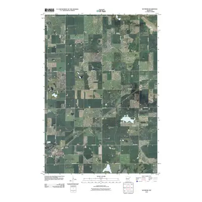
2010 Map of Raymond
USGS Topo · Published 2010About this map
Raymond anchors the southwestern corner of this survey, where the grid of local roads meets the diagonal rail line. This prairie landscape in Kandiyohi County is defined by its rectilinear section lines, such as 45th Ave SW and 120th St SW, which organize the agricultural terrain. The settlement of Priam sits to the northeast, connected to the primary town by the railroad corridor. For those tracing local heritage, the map identifies several distinct burial grounds, including Fairview Cemetery and the Trinity Lutheran Cemetery, along with the Saint John's Lutheran Cemetery south of town. The Kandi-Chippewa Line SW marks the western boundary of the quadrangle, illustrating the political and geographic divisions of this rural Minnesota region. The presence of the Raymond Post Office highlights the town's role as a local center of commerce and communication for the surrounding farmsteads.
Find a feature on this map
30 named features on this map. Tap any name to fly to it.
Don’t see what you’re looking for? This feature index may not catch every label — zoom into the map to look around manually.
Map Details
Editions of this 2010 Raymond Map
This is the sole edition of this map. No revisions or reprints were ever made.
Other maps of this area

1953 · New Ulm
USGS Topo · 1:250,000

1953 · Saint Cloud
USGS Topo · 1:250,000

1957 · Saint Cloud
USGS Topo · 1:250,000

1957 · New Ulm
USGS Topo · 1:250,000

1958 · New Ulm
USGS Topo · 1:250,000

1958 · Saint Cloud
USGS Topo · 1:250,000

1958 · Kerkhoven SE
USGS Topo · 1:24,000

1958 · Kerkhoven
USGS Topo · 1:24,000

1958 · Raymond
USGS Topo · 1:24,000

1958 · Pennock
USGS Topo · 1:24,000