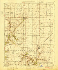
1925 Map of Raymond
USGS Topo · Published 1925About this map
Agricultural development and rural social infrastructure define the landscape of Montgomery County during the mid-1920s. The region is characterized by a dense network of country schoolhouses and churches, such as Star Union School, Boston Chapel School, and Shiloh Church, which served as the primary gathering points for farming families. The settlement pattern follows the critical rail corridors of the era, with towns like Farmersville, Raymond, and Waggoner acting as essential shipping points for local produce.
Find a feature on this map
73 named features on this map. Tap any name to fly to it.
Don’t see what you’re looking for? This feature index may not catch every label — zoom into the map to look around manually.
Map Details
Editions of this 1925 Raymond Map
2 editions found

Other maps of this area

1912 · Gillespie
USGS Topo · 1:62,500

1915 · Gillespie
USGS Topo · 1:62,500

1915 · Mount Olive
USGS Topo · 1:62,500

1922 · Divernon
USGS Topo · 1:62,500

1923 · Carlinville
USGS Topo · 1:48,000

1923 · Taylorville
USGS Topo · 1:62,500

1923 · Raymond
USGS Topo · 1:62,500

1924 · Divernon
USGS Topo · 1:62,500

1924 · Waverly
USGS Topo · 1:62,500

1925 · Taylorville
USGS Topo · 1:62,500