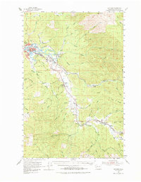
1955 Map of Raymond
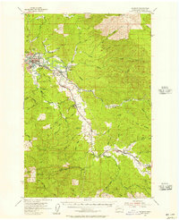
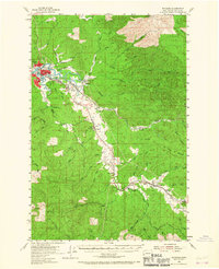
USGS Topo · Published 1985About this map
Raymond serves as the industrial and transport hub of Pacific County in this mid-century survey, situated at the confluence of several water bodies including Ellis Slough and the Willapa River. The landscape is defined by the river's winding path and the intensive rail network serving the timber and maritime interests of the region. The Chicago Milwaukee ST Paul And Pacific and the Northern Pacific railroads dominate the valley floor, connecting a string of small river settlements such as Willapa, Menlo, and Holcomb. Local social infrastructure is well-documented through features like the Riverdale Sch, Valley Sch, and Fern Hill Cem. Away from the main valley, the terrain rises toward P and E Ridge and Smith Butte, with numerous tributaries like Ward Creek and Fairchild Creek carving through the hills. The presence of the State Fish Hatchery near Nallpee and multiple gaging stations reflects the era's focus on resource management and hydrological monitoring.
Find a feature on this map
73 named features on this map. Tap any name to fly to it.
Don’t see what you’re looking for? This feature index may not catch every label — zoom into the map to look around manually.
Map Details
Editions of this 1955 Raymond Map
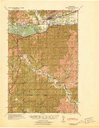
Other maps of this area

1938 · Fort Columbia
USGS Topo · 1:62,500

1938 · South Bend
USGS Topo · 1:62,500
1940 · Montesano
USGS Topo · 1:62,500

1940 · Brookfield
USGS Topo · 1:62,500

1940 · South Bend
USGS Topo · 1:62,500

1941 · Walville
USGS Topo · 1:62,500

1941 · Skamokawa
USGS Topo · 1:62,500

1941 · Ford
USGS Topo · 1:62,500

1943 · Fort Columbia
USGS Topo · 1:62,500

1949 · Upper Naselle River
USGS Topo · 1:24,000