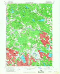
1966 Map of Reading
USGS Topo · Published 1968About this map
Quannapowitt Lake anchors the southern portion of this Middlesex and Essex county survey, where the bustling centers of Wakefield and Reading sit amidst a rapidly expanding suburban network. The mid-1960s landscape is defined by its transition from wooded state lands and swamps to residential developments and educational campuses. Significant institutional footprints are visible, including the Camp Curtis Guild National Guard Reservation and the North Reading Rehabilitation Center.
Find a feature on this map
122 named features on this map. Tap any name to fly to it.
Don’t see what you’re looking for? This feature index may not catch every label — zoom into the map to look around manually.
Map Details
Editions of this 1966 Reading Map
2 editions found
Other maps of this area

1886 · Lawrence
USGS Topo · 1:62,500

1888 · Lawrence
USGS Topo · 1:62,500

1888 · Salem
USGS Topo · 1:62,500

1892 · Boston Bay
USGS Topo · 1:62,500

1893 · Salem
USGS Topo · 1:62,500

1893 · Boston
USGS Topo · 1:62,500

1893 · Lawrence
USGS Topo · 1:62,500

1903 · Boston
USGS Topo · 1:62,500

1903 · Boston Bay
USGS Topo · 1:62,500

1917 · Salem
USGS Topo · 1:62,500