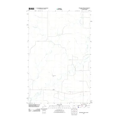
2011 Map of Red Bank Creek
USGS Topo · Published 2011About this map
Red Bank Creek and Little Muddy Creek meander through this section of Williams County, carving a series of drainages across the landscape. The infrastructure of the early 21st century is defined by a grid of rural roads and the presence of the Bainville Rest Area along a southern transit corridor. A notable water management feature, the Shields Fields Dam, sits at a junction of minor tributaries, illustrating the local reliance on managed water resources in this prairie environment. The map details a transition from traditional land divisions, marked by local routes like Haugen Rd and County Hwy 5, to more modern thoroughfares including 154th Ave NW. This survey preserves the exact placement of rural landmarks and drainage patterns before further development or environmental shifts could alter the terrain.
Find a feature on this map
12 named features on this map. Tap any name to fly to it.
Don’t see what you’re looking for? This feature index may not catch every label — zoom into the map to look around manually.
Map Details
Editions of this 2011 Red Bank Creek Map
This is the sole edition of this map. No revisions or reprints were ever made.
Other maps of this area

1953 · Williston
USGS Topo · 1:250,000

1954 · Wolf Point
USGS Topo · 1:250,000

1957 · Williston
USGS Topo · 1:250,000

1958 · Wolf Point
USGS Topo · 1:250,000

1968 · Trenton SW
USGS Topo · 1:24,000

1968 · Bainville SE
USGS Topo · 1:24,000

1969 · Bainville SW
USGS Topo · 1:24,000

1974 · Red Bank Creek
USGS Topo · 1:24,000

1974 · Bonetraill SW
USGS Topo · 1:24,000
1974 · Trenton NW
USGS Topo · 1:24,000