
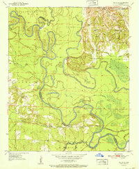
1951 Map of Red Bluff
USGS Topo · Published 1951About this map
Little River meanders in complex oxbows and loops across this southwestern Arkansas landscape, defining the jagged boundaries between Hempstead and Little River counties. The 1951 geography is dominated by river-bottom ecology, with numerous named backwaters like Beard Lake, Cypress Lake, and Red Lake filling abandoned channels. The high ground south of the river is anchored by the St Louis San Francisco railroad, which passes through the community of Red Bluff and the site of Moore Camp. Local genealogy is well-documented through the presence of several country churches and burial grounds, including Christian Ch, Hopewell Ch, and Spring Hill Cem. Near the northern border, Saratoga serves as a small population center, while landmarks like Shepherd Bluff rise above the meandering flats and bayous that define the region's drainage patterns.
Find a feature on this map
40 named features on this map. Tap any name to fly to it.
Don’t see what you’re looking for? This feature index may not catch every label — zoom into the map to look around manually.
Map Details
Editions of this 1951 Red Bluff Map
2 editions found
Other maps of this area

1950 · Ashdown East
USGS Topo · 1:24,000

1950 · Ogden
USGS Topo · 1:24,000

1950 · Red Bluff
USGS Topo · 1:24,000

1950 · Ben Lomond
USGS Topo · 1:24,000

1951 · Ben Lomond
USGS Topo · 1:24,000

1951 · Ogden
USGS Topo · 1:24,000

1951 · Ashdown East
USGS Topo · 1:24,000

1951 · Homan
USGS Topo · 1:24,000

1951 · Mineral Springs South
USGS Topo · 1:24,000

1951 · Fulton
USGS Topo · 1:24,000